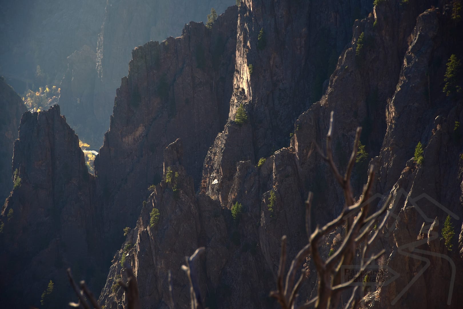
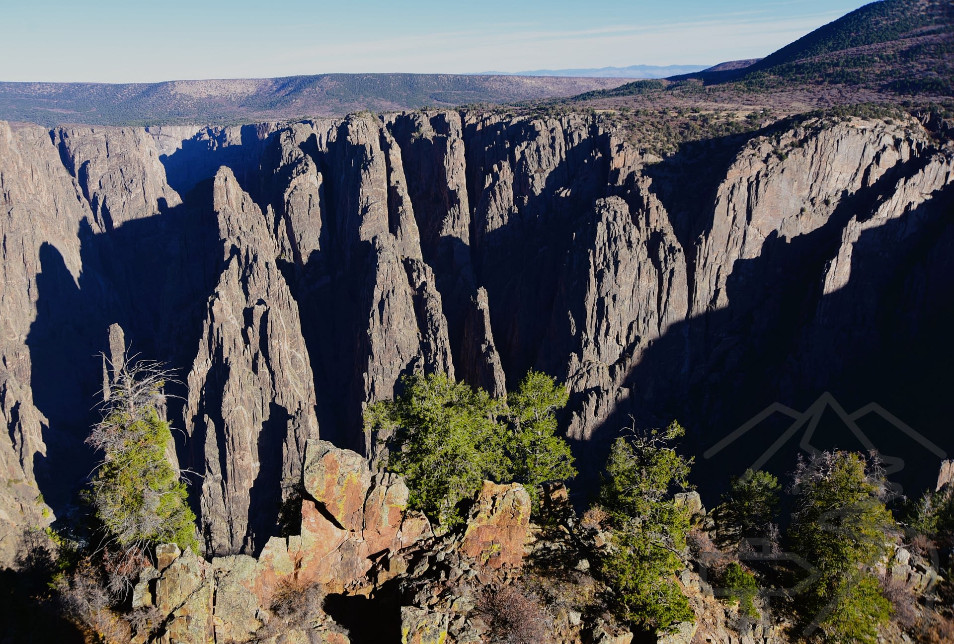
The Black Canyon of the Gunnison National Park in the state of Colorado is lesser known among the USA’s national parks. It guards an unbelievably deep canyon, with sheer walls comprised of both volcanic and metamorphic rock. The canyon evokes imagery from a fantasy series like The Lord of the Rings. The depth of the canyon, its sheer walls and spires, are beyond belief.
At its deepest, known as Warner Point, the canyon walls soar 2,722 feet from the river below. The canyon is also relatively narrow, with its narrowest point being only 1,100 feet (335 m) from rim to rim at Chasm View. The length of the canyon encompassed by the national park is 14 miles, although the total length of Black Canyon is 48 miles.

Introduction
Our visit to the Black Canyon of the Gunnison was part of a larger loop trip from Albuquerque, NM that also included Mesa Verde, Canyonlands, Arches, and Great Sand Dunes National Parks, and the city of Santa Fe, NM. Make sure to check out our other guides including the overview post of this Desert Southwest Itinerary.
Getting There
It’s not easy to get to this park, with the nearest city, Denver, CO, being almost 5 hours by car to the northwest. Moab, UT is 3 hours to the west of the park and Grand Junction, CO is about 1 hours to the northwest.
There is one entrance to the South Rim of the park and that is from Highway 347. You reach Highway 347 from Highway 50 at Montrose, CO.
Park Entrance Fees
The park entrance fee for a private vehicle is $30. Check out the Black Canyon of the Gunnison page on nps.gov for more fee information.
Note: If you will be visiting multiple national parks in the US within a twelve-month period, consider purchasing an America the Beautiful-National Parks and Federal Recreational Lands Pass. To purchase a parks’ pass, visit the National Park Services’ Entrance Passes page here.
Spending Your Day on the South Rim
Visiting the South Rim of the park allows you to see the canyon from many vantage points, complete a couple of short hikes – or one very strenuous hike, and drive down to the Gunnison River. (The road down to the Gunnison River is steep, but we were fine driving it in our small RV, going slowly and using a lower gear.)
The drive along the South Rim Drive from Tomichi Point to High Point is 7 miles. There are twelve overlooks along the way, none of which require more than a half mile of walking to view. We spent about 1/2 day exploring these stops.
For those with less time, our favorite stops on the South Rim are Gunnison Point, Rock Point View, Chasm View, and Painted Wall.
Stops Along the South Rim
We got up early and entered the park around 7:30 AM. From Montrose, CO to the entrance station is a little over 13 miles. At the entrance station, you will need to pay your entrance fee, or show your park pass. Arriving early, the entrance station was not open, so we breezed right in.
Tomichi Point / Rock Rim Trail
After passing the South Rim Campground, which is on the left shortly after the entrance station, you arrive at your first stop, Tomichi Point. Note: this stop is before the Visitor Center. Be careful not to miss it! Here we got our first jaw-dropping views into the canyon as the sun began to light up its walls.

South Rim Visitor Center / Gunnison Point
The South Rim Visitor Center features exhibits on the canyon and is located at Gunnison Point. The visitor center is open daily 8 AM – 5 PM throughout the summer, and 9 AM – 4 PM other times of the year. Check here to confirm the visitor center’s hours.

At Gunnison Point, there is a viewing platform with incredible views into the Black Canyon. This is one of the places where the steepness of the canyon walls and its granite spires seem like something from a fantasy.

Note: The South Rim Road beyond Gunnison Point is closed to vehicles in the winter.
Pulpit Rock Overlook
Pulpit Rock Overlook is next. This spot is mind-blowing, as from here, you can see a good length of the Gunnison River far below the sheer canyon walls.

Rock Point Overlook
This is an easy overlook to access with a short walk of a little more than 0.1 mile. From here, there are varied views of the canyon and the opposite canyon wall.


Cross-Fissures View
This viewpoint showcases the spines of jagged rock within the canyon and is a must stop. The roundtrip walk is 0.2 mile.

Devil’s Lookout
The trek to Devil’s Lookout is about 0.5 mile roundtrip. It is well worth the walk and by now, you will be ready to stretch your legs. At the lookout, the canyon is wide open and surrounded by sheer cliffs.

Painted Wall View
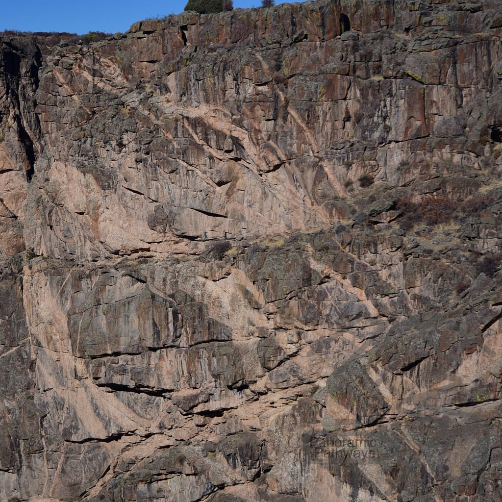
Painted Wall is famous for a reason! Featuring white bands of Pegmatite, this sheer wall is the highest cliff in Colorado, at 2,250 feet in height. As you gaze at the wall, it is hard to comprehend. And the colors of the different striations of rock create a striking scene. The walk to Painted Wall View is about 0.1 mile.

Chasm View
Chasm View is at the narrowest point of the Black Canyon. The sheer cliffs descend vertically straight down 1,820 feet to the Gunnison River. Pick your jaw up off the ground! Complete a 0.5 mile loop to take in Chasm View.

Cedar Point Overlook and Nature Trail
The nature trail here, a flat 0.7 mile roundtrip, is another good leg-stretcher and features signs describing plants along the trail. There are two overlooks at the end of the trail with amazing views into the canyon and of the Gunnison River more than 2,000 feet below. From here, you also have more views of the Painted Wall.

Dragon Point Overlook
Another must stop for different views of the canyon and river, and make sure to spot the dragon shape in the rock on the sheer wall here. Can you see it? It’s a short walk of about 0.2 mile to Dragon Point.

Sunset View Overlook
The Sunset View Overlook is a great place for a picnic or even to watch the sunset. The overlook is about 0.1 mile from the parking lot.

High Point Overlook / Warner Point Nature Trail
The last stop on South Rim Drive is at the High Point Overlook. The elevation here is 8,289 feet and there are sweeping views looking back over the Black Canyon.

The Warner Point Nature Trail is a 1.5 mile roundtrip hike. It’s not strenuous, but a little hilly. Try to complete this short hike. You will be rewarded with views to the south and west of the Uncompahgre Plateau and the San Juan Mountain range. Quite a contrast after hours staring into a deep canyon.

Hiking the Gunnison Route
There is one hike into the canyon from the South Rim. The Gunnison Route trail drops from the South Rim to the Gunnison River in 1.2 miles, with an elevation loss of about 1,700 feet. And what goes down must come back up!
We chose not to do this hike as we had limited time, the trail requires a Wilderness Permit, and we had read that it is covered in scree and loose gravel. Only a few people per day are permitted on the trail. I really hated not being able to do this hike! I’m sure it is a fantastic experience and an even better workout.
For details on the Gunnison Route hike and how to obtain a permit, check out one of the best guides for the hike we’ve seen.
The trailhead for the Gunnison Route is by the South Rim Visitor Center, which has toilets and plenty of parking.
East Portal Road / Driving to the Gunnison River
The East Portal Road takes you from the South Rim to the Gunnison River. The road descends steeply with grades up to 16% and sharp curves. Vehicles longer than 22 feet total, including trailers, are not allowed. Since our RV was 22 feet long, we just made the cut.
We were fine driving down, going slowly and using a lower gear.
Notes: According to the National Park Service: “Trailers may be left unhitched and left at a parking area at the campground entrance.” Also, the East Portal Road is closed in winter.
At the Gunnison River
After driving down the East Portal Road, you arrive in the Curecanti National Recreation Area. It’s hard to believe the extremes of the South Rim are just above you.

This is a magically beautiful area. The Gunnison Diversion Dam creates a lovely setting, and it is possible to drive along the river and choose an attractive picnic spot. This is a popular area for fishing. It is easy to pick a quiet spot to relax and enjoy the views.

Hiking the East Portal Trail
The East Portal Trail follows the Gunnison River for .4 mile (or .8 mile roundtrip). The sheer canyon walls rise up across the river. The first part of the trail is easy, but eventually you must pick/scramble your way over jagged rocks. I did a portion of the hike, letting Fred and Zach complete it while I sat on a rock enjoying the view of the river and the canyon walls.
Camping at Black Canyon of the Gunnison
South Rim Campground
We recommend the South Rim Campground. It’s always great when possible to stay inside the national parks. This campground is quiet and sites have partial shade. Book as early as possible since this campground fills up.
From the National Park Service website: “The South Rim Campground is located one mile from the South Rim Visitor Center. Reservations may be made on recreation.gov for mid-May to mid-October, and it is first-come first-served after that. Sites are fairly close together, and are partially shaded by Gambel oak and serviceberry bushes. Only Loop B offers 20 and 30 amp electric hookups. During the warm season, drinking water is available, but there are no showers or dish cleaning stations, and no water for RV tanks.”

Camping in Nearby Montrose, Colorado
When we tried to reserve a spot at the South Rim campground for the night before our visit, it was already full. Thankfully, we were able to camp at the Cedar Creek Lodging and RV Park in Montrose, CO, 15 miles from the South Rim Visitor Center. Since our stay, it appears that it has been remodeled and has added some glamping accommodations.
One great thing about having some time in Montrose was an opportunity to spend a little time at the quirky, fun Museum of the Mountain West. I would not drive too far out of the way to visit the museum but it is certainly worth a stop if you are passing through. The proprietor was quite knowledgeable and we saw some interesting items.
A Note on Visiting the North Rim
To get to the North Rim from the South Rim requires a drive of about two hours. Furthermore, the last 7 miles of road approaching the North Rim, and the entire road along it, are gravel. While I’m sure the North Rim is amazing, we chose not to fit it into our travel plans. This fits with our travel philosophy. We value our time and money and want to visit and experience as many places as we can. Maybe there will be a next time!
Other Related Guides
Check out our guides for Canyonlands National Park, Arches National Park, and Great Sand Dunes National Park. We’ve also created a Desert Southwest Itinerary to help you plan your trip.