Updated March 2026 with new itinerary tips, hikes, and planning information
Located in southwest Utah, Arches National Park contains some of the world’s most terrific rockscapes and should be on every nature-lover’s travel bucket list. Featuring more than 2,000 natural sandstone arches as well as other amazing rock formations, open vistas, and big skies, Arches astounds at every turn. The contrasts of the red and beige sandstone against the blue sky are a photographer’s dream.
Before traveling to Arches National Park for the first time in 2002, I read Edward Abbey’s masterpiece, Desert Solitaire (affiliate link). My longings to experience Arches were born. A lot has changed since 1968 when the book was published. Now it’s hard to find solitude at Arches, which is not surprising considering its beauty and natural wonders.
When we returned more recently, we were amazed by the multitudes of people who have now discovered it. Many areas required jostling with crowds.
But if you plan ahead — visiting the most popular places early in the morning or later in the evening, and choosing a few quieter hikes during peak hours — you can still fully enjoy everything that makes Arches so magnificent.
Know Before You Go
Arches National Park Location
The park sits just outside the town of Moab, Utah. The entrance station is about 5 miles northwest of town.
Timed Entry (2026 Update)
The National Park Service experimented with timed entry in recent years, but Arches National Park is not requiring timed entry reservations in 2026. You will still need to pay the entrance fee or use an America the Beautiful annual park pass.
How Much Time to Allow
You can see the highlights in one full day, but two days is ideal if you want to include several hikes. The park is not huge, but there are many stops along the scenic drive, and hiking can easily fill half a day.
When to Visit
Spring and fall offer the best temperatures. Summer can be extremely hot. Sunrise and sunset are magical here — not just for photography but also because crowds thin out dramatically.
🗺️ Planning a Desert Southwest Road Trip?
Arches National Park was one stop on our Desert Southwest loop trip, which included several national parks and iconic landscapes. If you’re planning a similar adventure, our full itinerary may help you map out your route.
Renting an RV for the first time can feel intimidating — but with a little preparation it’s one of the best ways to explore the national parks of the American Southwest. For this trip we also rented an RV in Albuquerque, which allowed us to create a loop through the region, staying close to the parks along the way. If you’re considering an RV trip but aren’t sure where to start, we share everything we learned about renting an RV, driving it, what to bring, and what to expect at campgrounds.
👉 See our Desert Southwest itinerary and route
👉 How to Rent and Travel by RV in the Desert Southwest
Arches Scenic Drive Mileages
Mileages from Entrance Station and Visitor Center
Click the links in the table below for more detailed area maps.
| Location | Distance | Drive Time |
|---|---|---|
| to Balanced Rock | 9.2 miles (14.8 km) | 15-20 minutes |
| to The Windows Section | 12 miles (19.3 km) | 25-30 minutes |
| to Wolfe Ranch / Delicate Arch Trailhead | 13.2 miles (21.2 km) | 30-35 minutes |
| to Delicate Arch Viewpoint | 14.2 miles (22.8 km) | 30-35 minutes |
| to Devils Garden | 18 miles (28.9 km) | 40-45 minutes |
Driving the Arches Scenic Drive: Stops in Order
The main road through the park is Arches Scenic Drive, which runs roughly 18 miles from the Visitor Center to the Devils Garden area at the end of the road. Most of the park’s famous formations lie along this route or along short spur roads. We recommend driving the park from south to north, stopping along the way.
Note: When driving the park, you’ll notice something amusing about many of the formations in Arches: the names are often wonderfully descriptive. Park rangers and early visitors clearly had fun naming what they saw. In many cases, a quick glance will tell you exactly what inspired the name — from the Three Gossips and Sheep Rock to the precariously perched Balanced Rock. As you explore the park, keep an eye out for these formations and see how many you recognize before reading the sign.
Arches National Park Visitor Center (Mile 1)
Located just beyond the entrance station, the visitor center is the best place to:
- check trail conditions
- ask about ranger programs
- refill water bottles
- use restrooms
The building also contains exhibits explaining how the arches formed.
Immediately after leaving the visitor center, the road climbs a series of steep switchbacks. Within minutes you are surrounded by towering sandstone cliffs — an incredible introduction to the park.
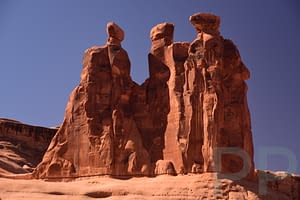
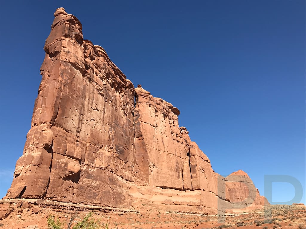
Park Avenue and Courthouse Towers (Mile 2)
This is one of the most dramatic viewpoints in Arches.
Sheer sandstone walls rise on both sides of a broad canyon floor, resembling a corridor of skyscrapers — hence the name Park Avenue.
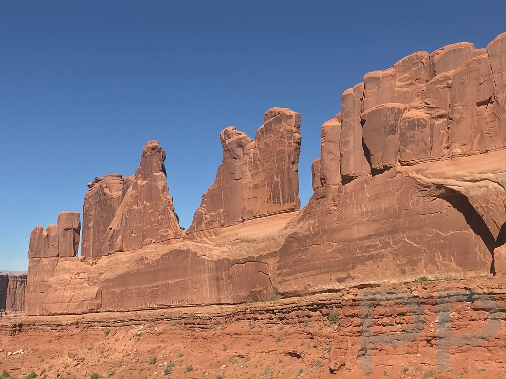
From the viewpoint you can see several formations including:
- Courthouse Towers
- The Three Gossips
- Sheep Rock
Park Avenue Trail
This excellent hike descends into the canyon.
The trail begins with a steep descent and ends with a steep climb, but walking through the canyon surrounded by towering rock walls is unforgettable.
Distance: 2 miles roundtrip
Difficulty: Moderate (steep climb on the return)
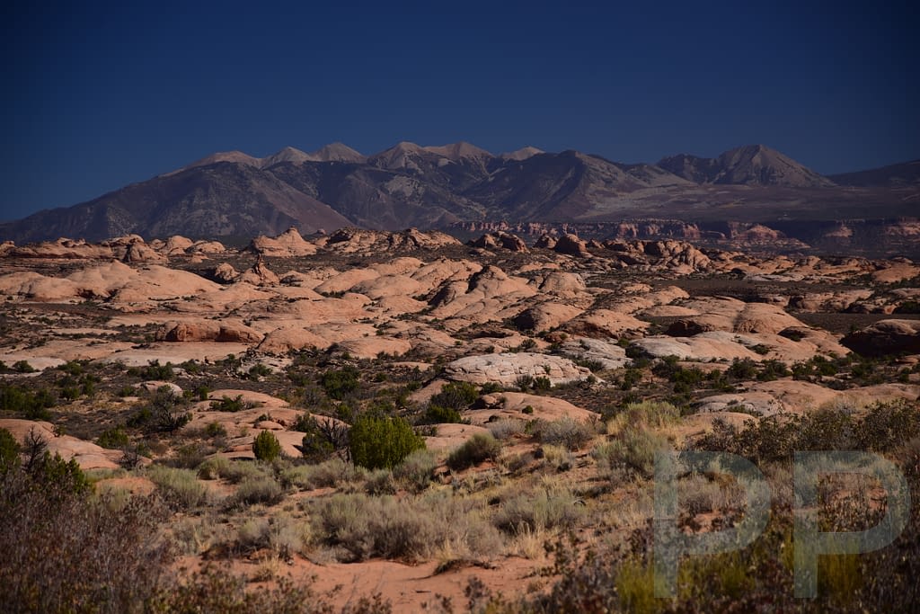
La Sal Mountains Viewpoint (Mile 2.8)
A short paved path leads to this scenic overlook.
From here you can see the La Sal Mountains rising dramatically in the distance, along with formations in the Courthouse Towers area. Looking out across the Courthouse Towers area, you may also notice a formation called The Organ, a series of vertical rock columns that resemble the pipes of a giant pipe organ.
It’s a quick stop but offers beautiful views.
Courthouse Towers Viewpoint (Mile 4)
This viewpoint provides a wide perspective of the massive sandstone formations known as the Courthouse Towers.
The towering rock formations resemble a giant courthouse complex rising from the desert floor.
You can also see the famous Three Gossips formation from here.
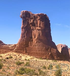
Tower of Babel (Mile 4.5)
One of the most striking rock fins in the park, the Tower of Babel rises nearly 300 feet into the air.
You’ll pass it shortly after the Courthouse Towers viewpoint. It’s visible from the road but worth pulling over to admire.
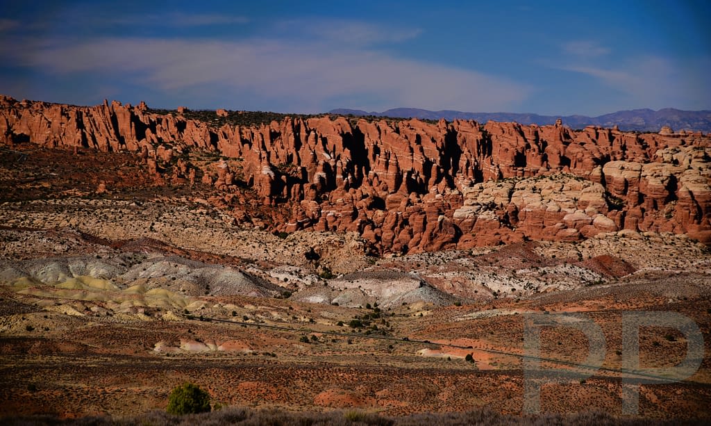
Petrified Dunes Viewpoint (Mile 6)
This overlook reveals a landscape of ancient sand dunes that have hardened into rock.
The swirling patterns in the stone are fascinating, and the distant La Sal Mountains create a beautiful backdrop.
The Great Wall (between Petrified Dunes and Balanced Rock)
As you continue north along the park road after the Petrified Dunes Viewpoint, look to the west for a long line of towering sandstone cliffs and fins known as The Great Wall. This massive formation stretches across the landscape like a natural fortress, rising dramatically from the desert floor. It’s not an official stop with a designated viewpoint, but it’s hard to miss and provides another reminder of the incredible scale of the rock formations throughout Arches.
Balanced Rock (Mile 9)
Balanced Rock is one of the park’s most recognizable formations. A huge boulder appears to be balancing precariously on a narrow pedestal.
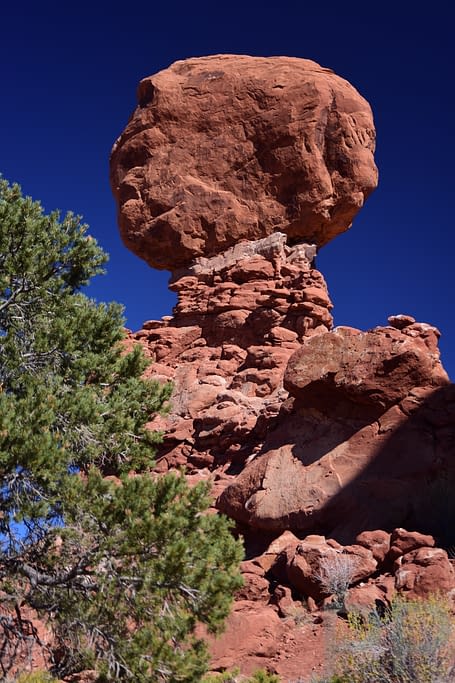
Balanced Rock Trail
A short trail circles the formation. This is an easy stop and definitely worth a few minutes.
Distance: 0.3 mile loop
Difficulty: Easy
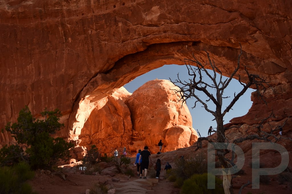
The Windows Section (Mile 12)
The Windows area is one of the most popular sections of the park because several impressive arches are located close together.
It’s a great place to stretch your legs and explore.
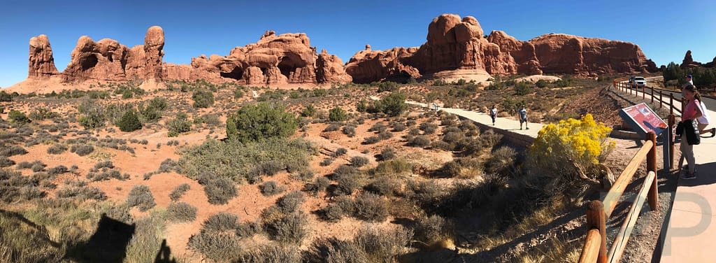
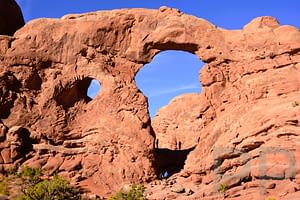
Windows Loop and Turret Arch
This loop takes you past North Window, South Window, and Turret Arch. You can walk right up to the arches and even look through them to the surrounding landscape.
Distance: 1.2 miles roundtrip
Difficulty: Easy
Double Arch
Double Arch is reached via a short 0.3-mile walk each way (0.6 miles roundtrip) from the Windows parking area, making it one of the easiest and most rewarding stops in the park. It’s the second-largest arch in the park, and its massive twin openings create an enormous natural chamber. Lie back on the rock and look up — the scale is incredible.
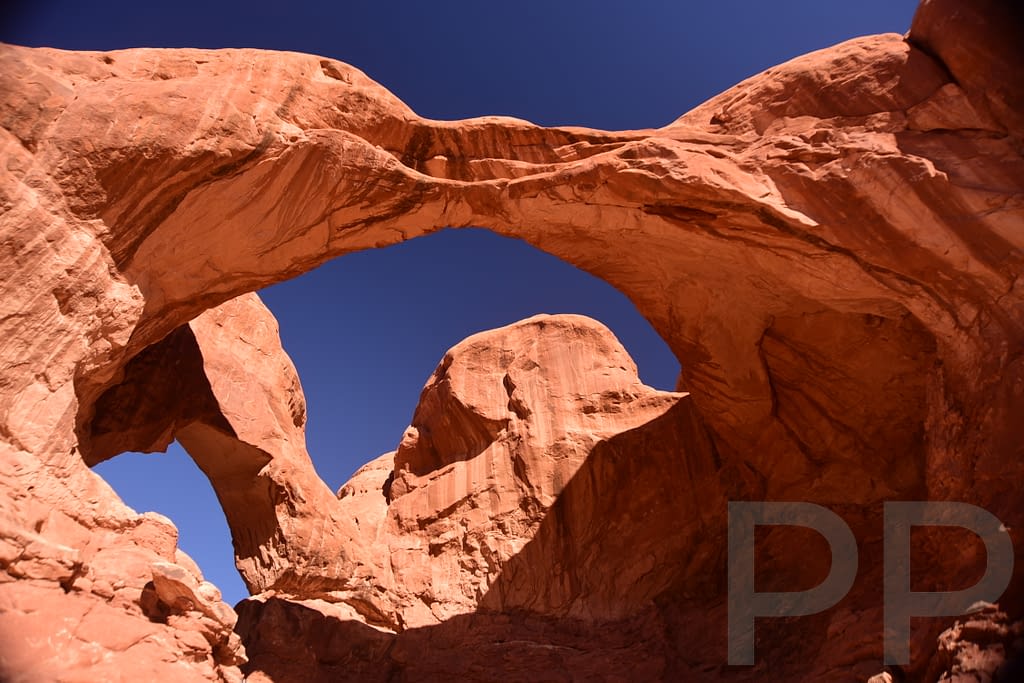
Nearby is a formation called Parade of Elephants, which looks uncannily like a line of elephants marching across the desert.
Panorama Point (Mile 13)
Panorama Point offers sweeping views across the park.
From this high vantage point you can see the La Sal Mountains, the Fiery Furnace area, and Devils Garden.
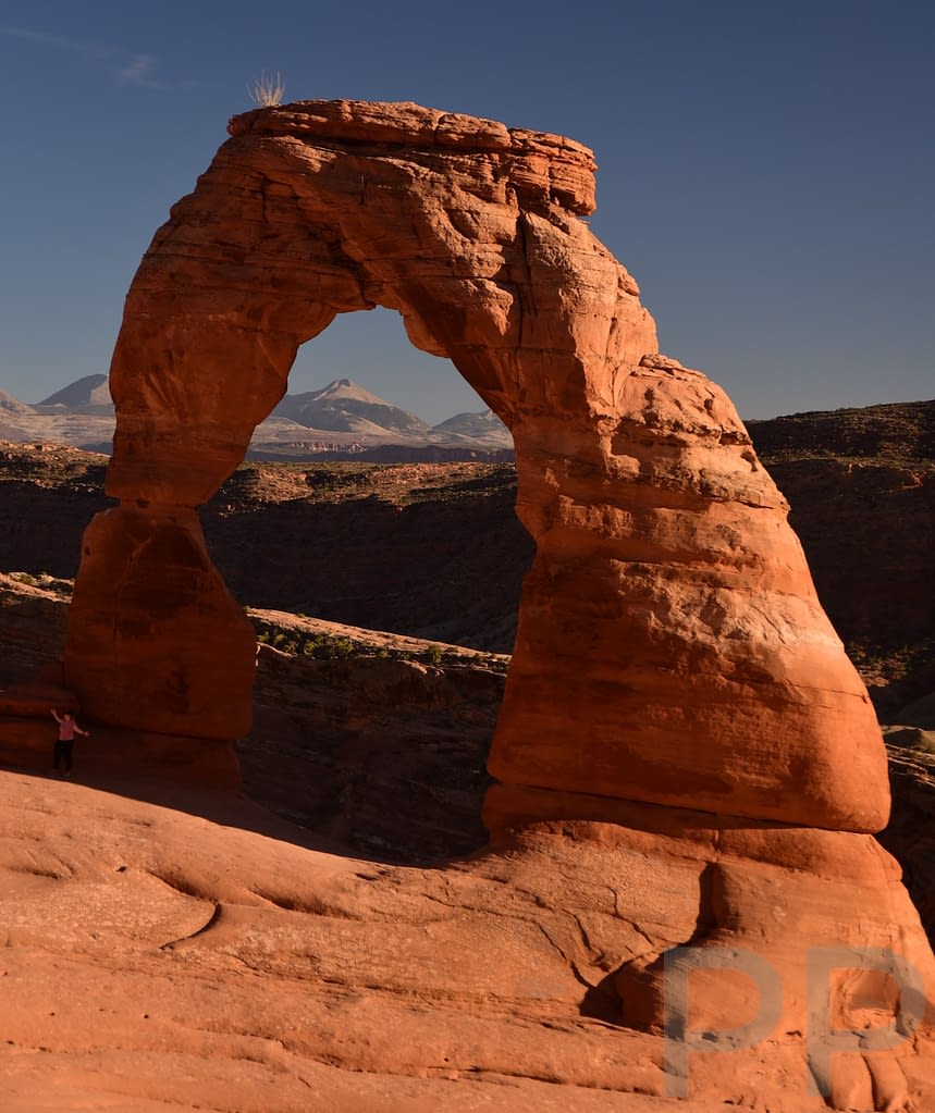
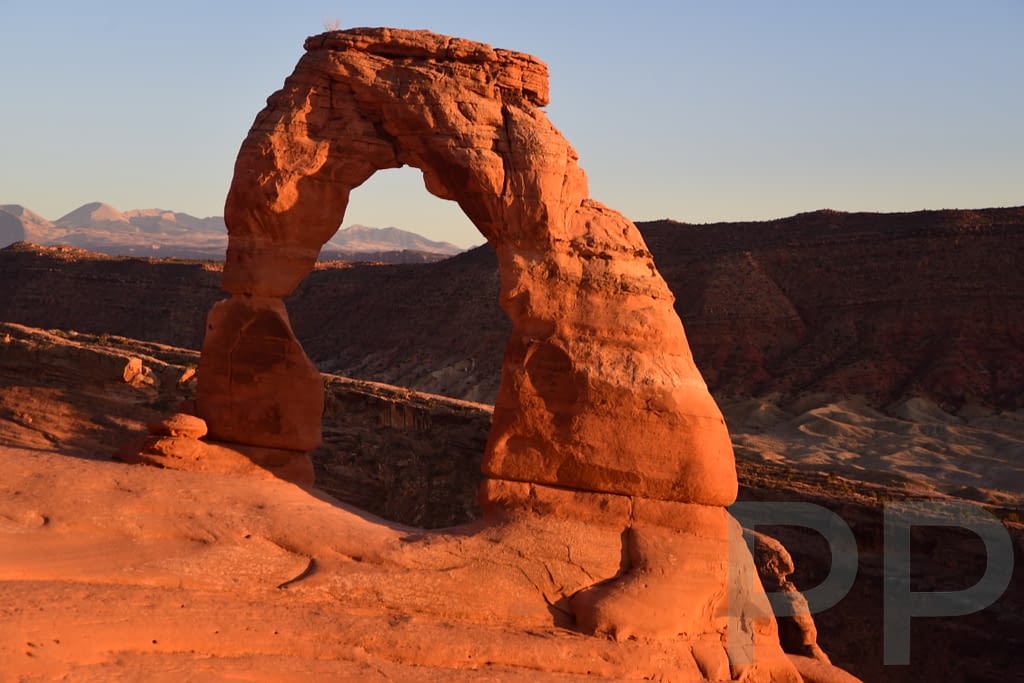
Delicate Arch Turnoff (Mile 14)
Delicate Arch is the most famous arch in the park and one of the most recognizable natural landmarks in the United States.
To truly appreciate it, you need to hike to it.
Delicate Arch Hike
Distance: 3.2 miles roundtrip
Difficulty: Moderate
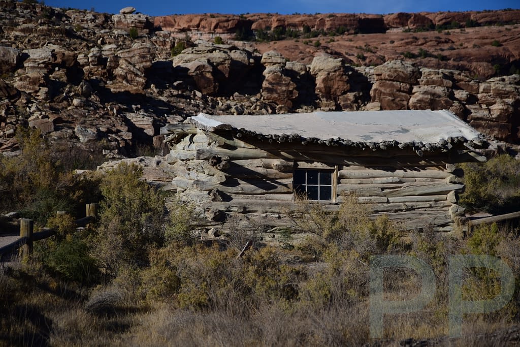
Near the start of the trail you’ll pass the historic Wolfe Ranch cabin, built in the late 1800s by early settler John Wesley Wolfe. From there, the hike begins on gravel before climbing steep slickrock. The middle portion is the most strenuous.
The final section follows a narrow ledge along a sandstone wall. I have some height anxiety — not real fear, but my body definitely starts pumping adrenaline — so that stretch was a bit stressful for me. Then you round the final corner — and suddenly Delicate Arch stands alone against the sky. It’s worth every step.
When you arrive at Delicate Arch, you reach a rock “bench” where you can stop and take in the view. The space is spectacular and huge. Between you and the Arch is a huge “bowl” of slickrock, surrounded by sandstone walls. Beyond the arch lies the magnificence of the surrounding country and the La Sal Mountain range. Sit awhile and take it in. Then walk down into the bowl for photos, and finally, stand at or under the arch.
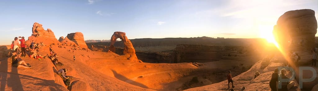
Delicate Arch can become crowded, making it difficult to fully enjoy your time there. Plan to arrive early or late.
The roundtrip hike to Delicate Arch, including time spent at the arch, takes about 3-4 hours, depending on your hiking speed.
Viewing Delicate Arch Without Hiking
Two viewpoints allow you to see the arch from a distance:
Lower Viewpoint – 100 yard paved walk
Upper Viewpoint – 0.5 mile walk with stairs
Salt Valley Overlook (Mile 16)
Only a very short stroll from the parking area, this overlook provides expansive views across Salt Valley, a huge area of salt flats. Bring your camera!
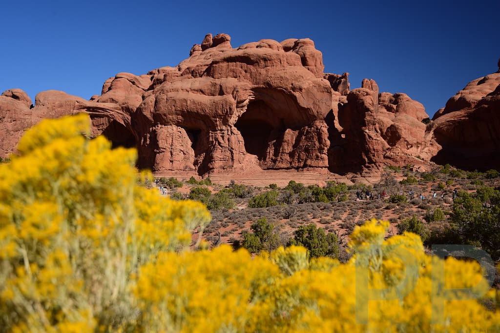
Fiery Furnace (Mile 16)
The Fiery Furnace is a maze of narrow sandstone fins and passages. At sunset the rock formations glow bright red, which is how the area earned its name.
Access is restricted. Visitors must either join a ranger-led tour, or obtain a special permit.
The terrain involves scrambling and squeezing through narrow rock corridors. A tour of the Fiery Furnace is a highlight of any trip to Arches National Park!
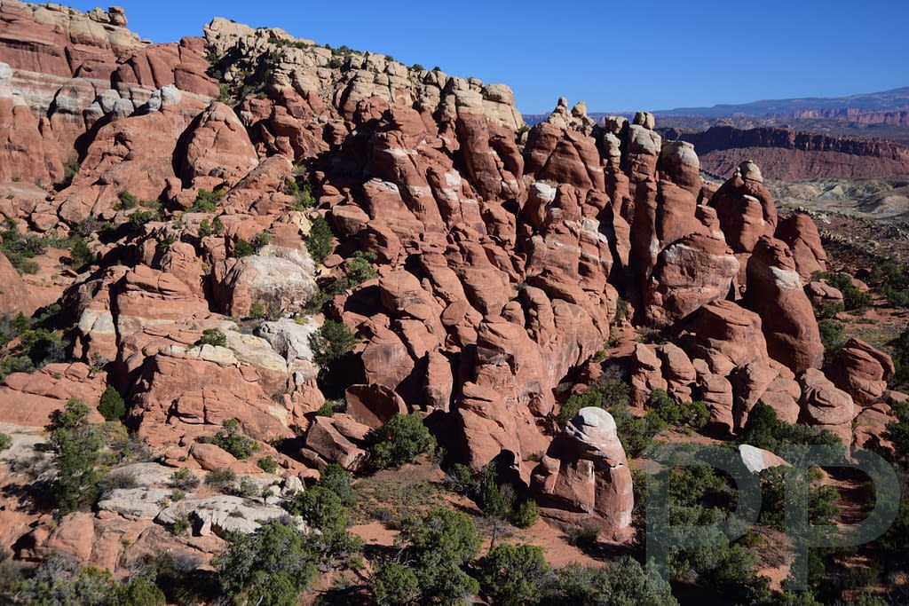
Sand Dune, Broken, Tapestry, and Skyline Arches (Mile ~17)
Continuing north along Arches Scenic Drive, you soon reach the Sand Dune / Broken Arch parking area. There are actually two nearby parking areas that serve this part of the park. The Sand Dune / Broken Arch parking area is the starting point for the loop hike to Sand Dune, Broken, and Tapestry Arches, while Skyline Arch has its own small parking pullout along the main park road.
Several arches are located close together in this part of the park, and they can easily be combined into a pleasant loop hike of about 2.6–2.8 miles.
The terrain here is varied and enjoyable, passing through sandy washes, narrow sandstone fins, and open desert meadows. Because this area sits slightly off the main road and spreads visitors across several trails, it often feels less crowded than some of the park’s most famous stops.
If you prefer not to hike very far, you can still see several highlights with short walks from the parking areas. Sand Dune Arch requires only a brief stroll from the Sand Dune trailhead, and Skyline Arch can be reached with a very short walk from its own nearby parking pullout along the park road.
Those who want to explore more can continue on the loop trail to visit Broken Arch and Tapestry Arch, creating a relaxed and scenic hike through this section of the park.
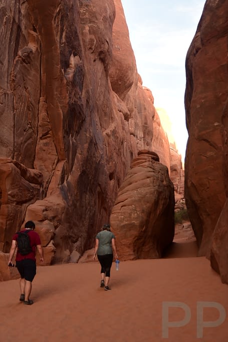
Sand Dune Arch
Sand Dune Arch sits tucked between narrow sandstone fins. A short trail leads through deep sand and shaded rock corridors before opening to the arch itself.
Because the surrounding rock walls block much of the sunlight, this area often feels noticeably cooler than other parts of the park. The walk to the arch is short and easy, making it a good stop even if you are not planning to hike the full loop.
Broken Arch
Continuing along the trail brings you to Broken Arch, a large arch standing in an open desert setting.
Despite its name, the arch is still fully intact. The name comes from a crack visible along the top of the formation. This arch is located away from the main road, so it often feels quieter than some of the park’s more famous arches.
Tapestry Arch
Tapestry Arch lies along the trail between Broken Arch and Devils Garden Campground.
The sandstone beneath the arch shows intricate erosion patterns that resemble woven fabric, giving the arch its name. This is a smaller but attractive arch and a pleasant stop along the loop hike.
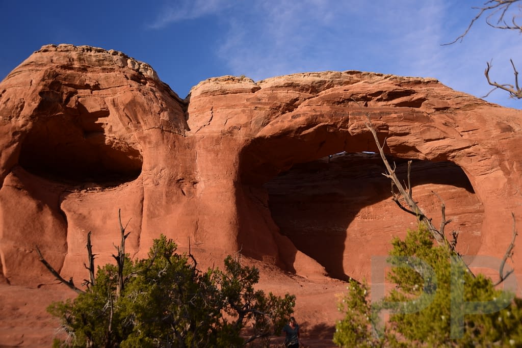
Skyline Arch
Skyline Arch sits high in a sandstone wall and is visible from the road.
A short trail of about 0.2 miles each way (0.4 miles roundtrip) leads to the base of the arch. In 1940 a large section of rock collapsed, dramatically widening the opening and creating the broad arch visible today.
Loop Hike Distances near Mile 17
The arches in this area can easily be combined into a loop hike of about 2.6–2.8 miles. Distances below are approximate and measured from the Sand Dune / Broken Arch parking area.
| Destination | Distance (One Way) | Distance (Roundtrip if Out-and-Back) |
|---|---|---|
| Sand Dune Arch | 0.3 miles | 0.6 miles |
| Broken Arch | 1.0 mile | 2.0 miles |
| Tapestry Arch | 1.3 miles | 2.6 miles |
| Skyline Arch* | 0.2 miles from Skyline parking area | 0.4 miles |
*Skyline Arch is typically visited from its own parking area along the park road rather than from the loop trail.
Typical Complete Loop Distance: ~2.6–2.8 miles
Devils Garden Area (End of Road)
Devils Garden lies at the very end of the scenic drive and contains some of the best hiking in the park.
Major highlights include:
- Landscape Arch
- Double O Arch
- the Primitive Trail
- Dark Angel
Because this area offers so many excellent hikes, we’ve written a separate detailed guide to Devils Garden.
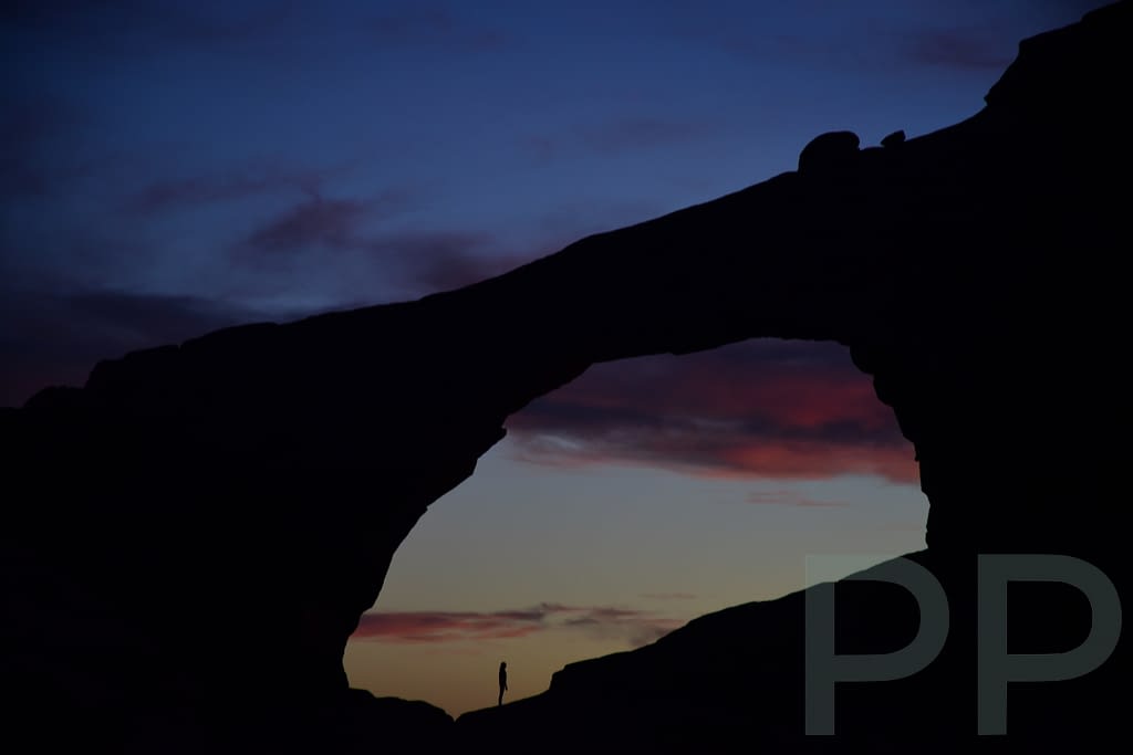
Stargazing in Arches National Park
Arches National Park is an International Dark Sky Park, meaning the night skies here are exceptionally clear and free from light pollution. On clear nights, thousands of stars become visible across the desert sky.
One of the best places in the park for stargazing is the Devils Garden area at the end of Arches Scenic Drive, where the sky feels incredibly vast and dark. If you are staying nearby or camping in the park, consider returning after sunset to experience the night sky. See our Devils Garden guide for more on hiking, camping, and stargazing in this part of the park.
Best Hikes in Arches National Park
If you’re planning to hike while visiting Arches, these are some of the most rewarding trails.
Delicate Arch
The park’s most iconic hike. Expect a steep slickrock climb and some exposure near the end, but the payoff is enormous.
3.2 miles roundtrip with a steep slickrock climb. Difficulty: moderate.
Park Avenue Trail
One of the most dramatic short hikes in the park.
Walking through the canyon surrounded by towering rock walls is unforgettable. Difficulty: moderate, mainly because of the steep climb back out.
Windows Loop
An easy and rewarding walk with several arches close together — ideal for first-time visitors.
Double Arch
Very short, very easy, and one of the most visually dramatic stops in the park.
Devils Garden Trails
Devils Garden offers some of the most adventurous hiking in the park.
See our Devils Garden guide for details.
Where to Stay
Moab, Utah
Most visitors stay in nearby Moab, which has many hotels, restaurants, and tour operators. It’s also the main base for visiting Canyonlands National Park.
Dead Horse Point State Park
Located nearby, this state park sits high above the Colorado River and offers camping and yurts with spectacular views.
Camping – Devils Garden Campground
Devils Garden Campground is the only developed campground inside Arches National Park. Its 51 sites are located in a beautiful setting at the end of the park road, about 18 miles from the entrance.
The campground is extremely popular and often fills months in advance during spring and fall, so booking as early as possible is recommended. From March 1 through October 31, all campsites must be reserved in advance through Recreation.gov, and reservations can be made up to six months ahead of your arrival date. From November through February, campsites are first-come, first-served and paid for using Recreation.gov’s Scan & Pay system.
Camping here allows you to explore the Devils Garden trails early in the morning and in the evening, when the light is beautiful and the crowds are much smaller.
Final Thoughts
I often feel nostalgic for Arches National Park. Whether it’s the open skies, the colors, the improbability and variety of the rock formations, or the ink-black night skies with millions of stars – it stays with me unlike any other place. I often catch myself reminiscing about my time there — and dreaming about when I can return. I hope you’ll love it too!
Wonderful!
I know this is going to be a great resource for our trip in April!!
Thanks Charlene. Please let us know what you find helpful. Also, let us know what other destinations you have in mind and we will get you info on those (if we have been there).
We leave next month for the big 5 – so I’m reviewing this again. Such great info … I’m excited! Will touch base if we have pre departure questions.
Please do. We have more info on some of the other NPs and sites we have visited that we have not gotten a chance to post yet. We would love to help where we can.
Comments are closed.