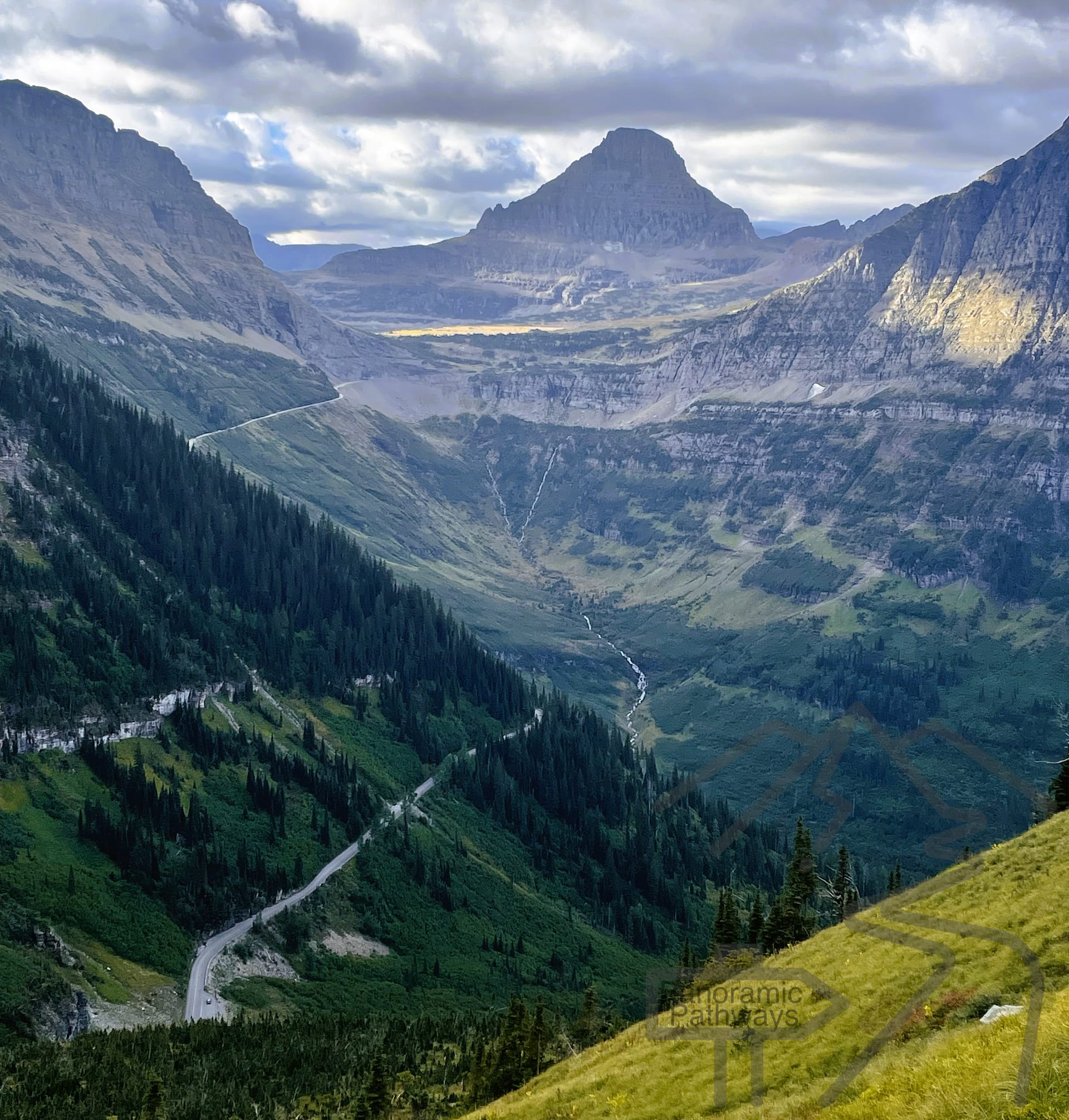
When we planned our trip to Glacier National Park, the Highline Trail kept topping every list of unforgettable hikes. The photos were irresistible—alpine meadows, sweeping views, and that dramatic ledge high above the Going-to-the-Sun Road (GTSR). But one detail gave us pause: the full round-trip from Logan Pass to the Granite Park Chalet and back is nearly 16 miles. That’s more than we wanted for a single day.
After some digging, we found the perfect solution—a one-way version of the hike that still covers all the highlights, but without the exhausting return leg. By starting at Logan Pass and descending via The Loop Trail, we could hike the Highline Trail mostly downhill, then catch the park’s free shuttle back to our car. It turned out to be the ideal balance of challenge, scenery, and efficiency.
Last Updated October 20, 2025
Why This Route Works So Well
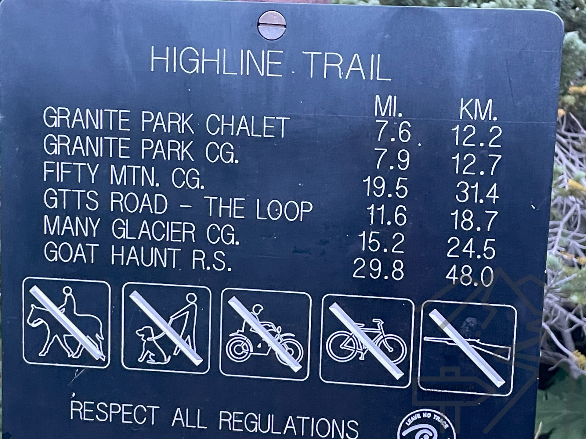
This 11.7-mile one-way route combines:
- 7.6 miles on the Highline Trail from Logan Pass to Granite Park Chalet, and
- 4.1 miles down The Loop Trail to The Loop on the GTSR.
It’s best done in this direction, since Logan Pass sits more than 2,200 feet higher than The Loop. You’ll only climb about 800 feet total along the way, which makes the hike feel relatively flat and fast—especially for Glacier.
We stopped frequently for photos, snacks, and a picnic at the Chalet, yet still finished in about six hours. It’s a big day, but not a grueling one.
Getting Started: Parking, Sunrise, and the Trailhead
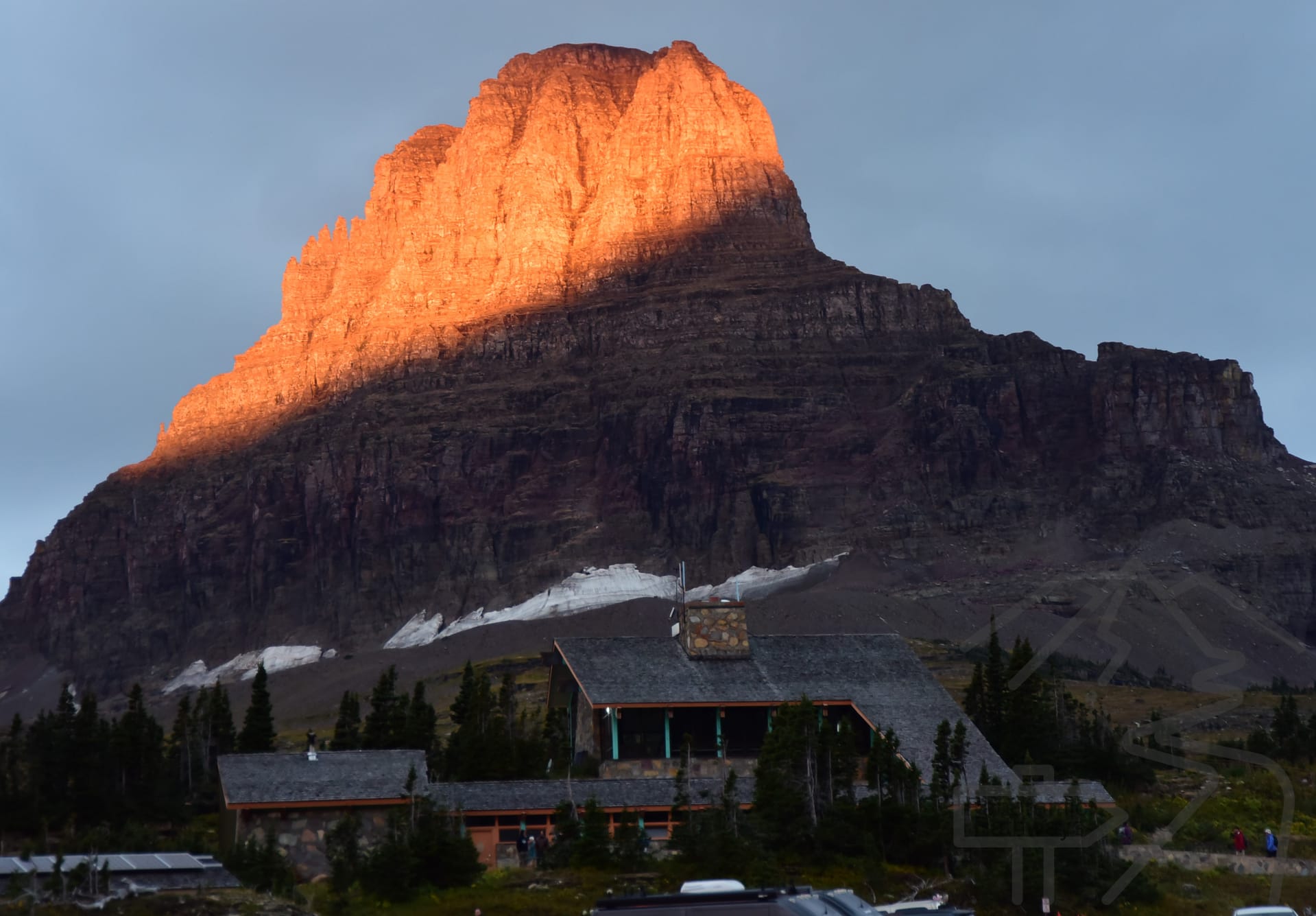
Plan to arrive early—the Logan Pass parking lot fills quickly on nice days. We started just after sunrise and were rewarded with a golden glow lighting up Mount Reynolds and the surrounding peaks. It’s worth lingering for a few photos before you hit the trail.
You’ll find restrooms at the Logan Pass Visitor Center (your last chance until Granite Park Chalet). The Highline Trailhead is directly across the Going-to-the-Sun Road from the Visitor Center.
From the first steps, the views are astonishing—massive valleys, distant peaks, and the GTSR winding far below.
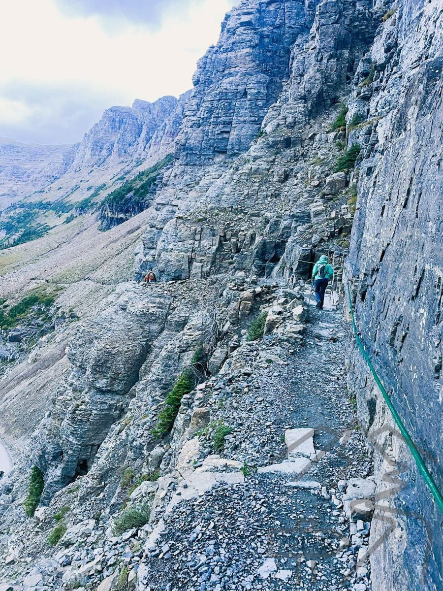
The Famous “Ledge” Section
Early in the hike, you traverse a narrow stretch carved into the cliffside above the road, often called the Ledge. It’s dramatic, but surprisingly manageable—even for those with a fear of heights. The trail is wide enough to feel safe, and green safety ropes are installed along parts of the cliff to give extra confidence.
If you’re prone to vertigo, stay to the inside wall and take your time. Trekking poles can add a sense of stability here—and they’ll be very useful later on the long downhill.
Along the Garden Wall
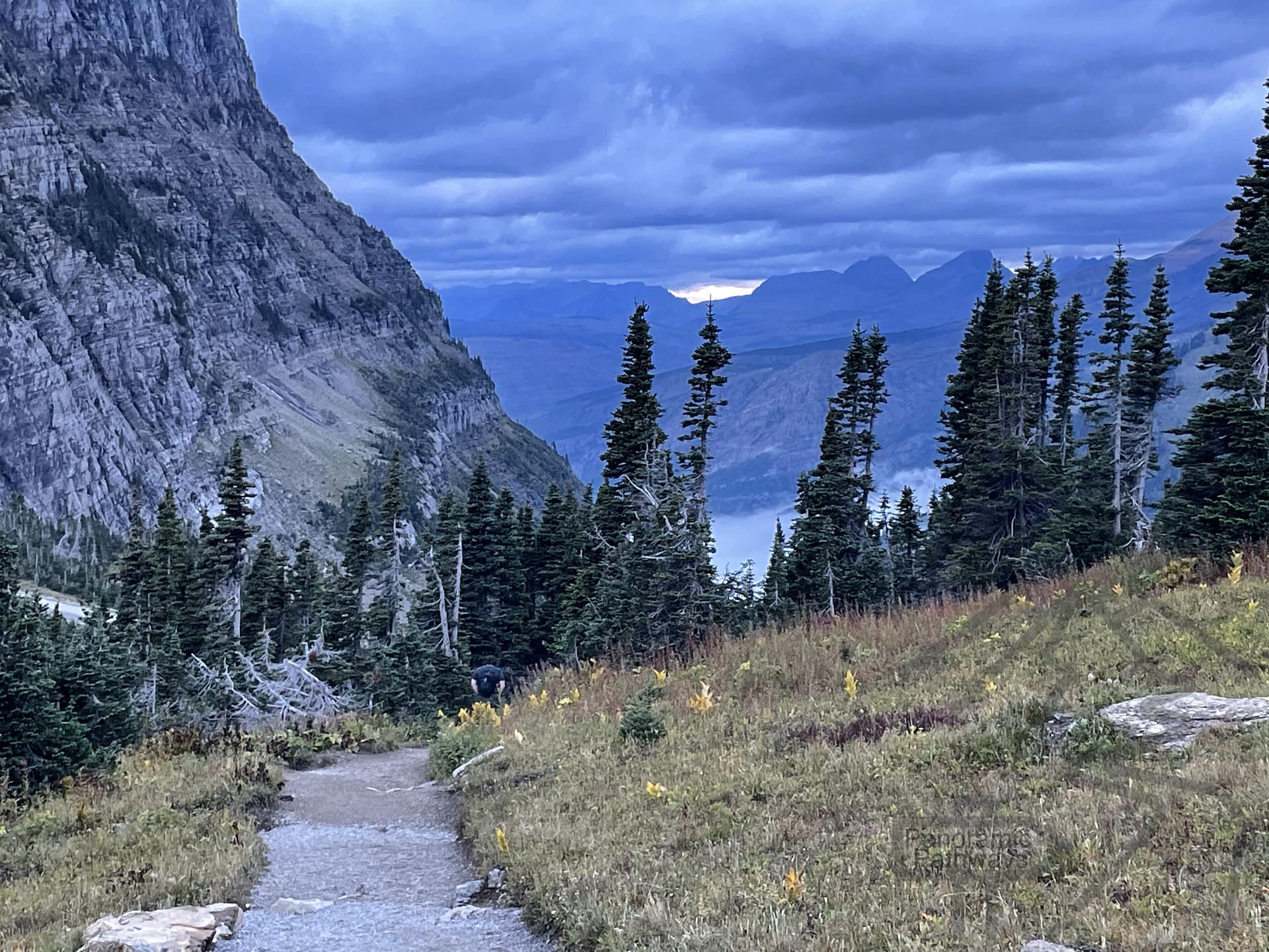
For roughly the first 2½ miles, the Highline Trail contours along the Garden Wall, a high alpine slope on the west side of the Continental Divide. The path is mostly level here, crossing wildflower meadows and open slopes with continuous views.
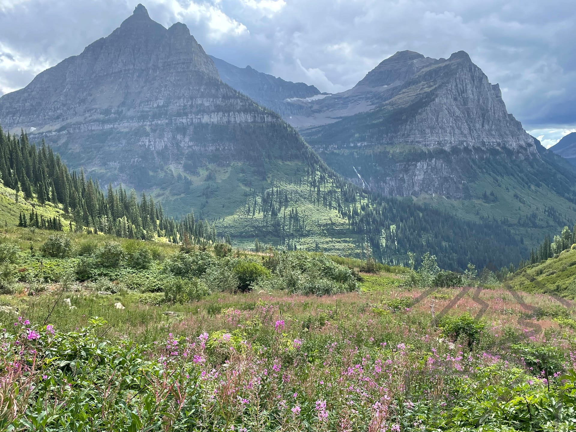
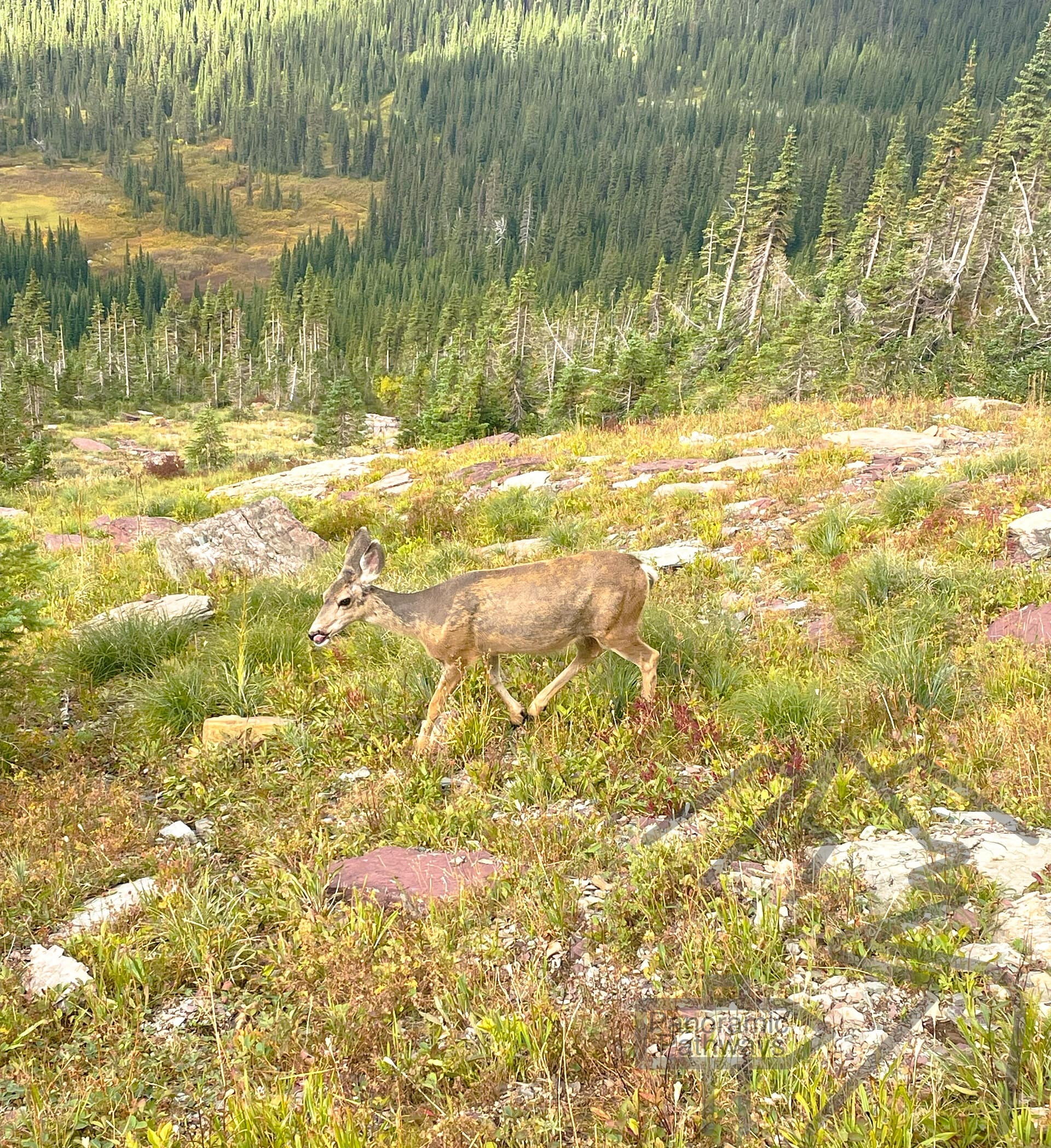
Even in September, we saw bursts of color from late-season blooms, along with deer and bighorn sheep grazing in the distance.
The Climb to Haystack Pass
At about 3½ miles, the trail begins its main climb—one long switchback up to Haystack Pass at just over 7,000 feet. This is the toughest section of the route, but the reward is a panoramic rest spot perfect for water and snacks.
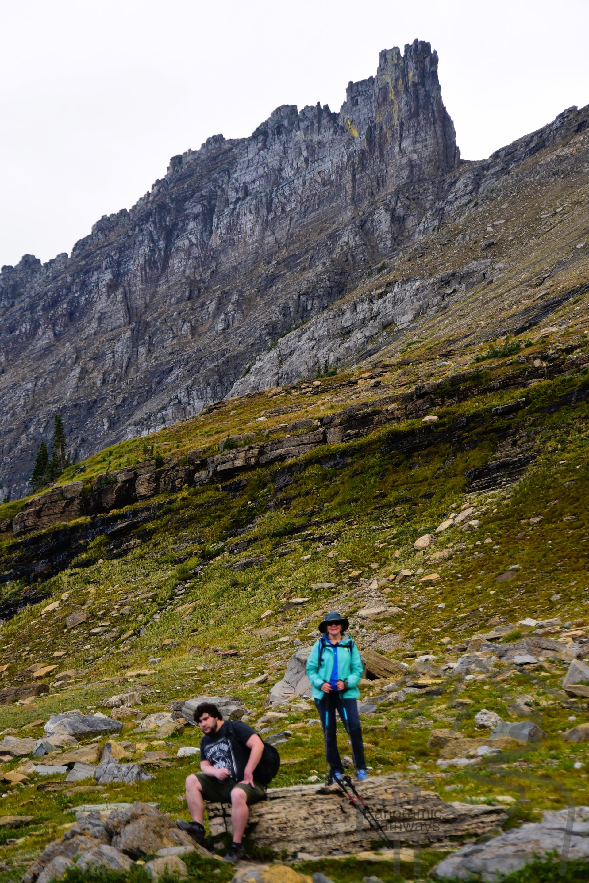
From the pass, the trail continues to rise gently for another half-mile to its high point at 7,289 feet, before beginning a gradual descent toward the Chalet.
Optional Spur: Grinnell Glacier Overlook
Just past the high point, a spur trail climbs steeply to the Grinnell Glacier Overlook—a two-mile round trip with nearly 1,000 feet of extra elevation gain. It’s steep, exposed, and crosses a loose scree slope. We decided to skip it, knowing we’d hike to Grinnell Glacier separately from the Many Glacier area later in our trip.
If you have the time and stamina, though, this overlook offers one of Glacier’s most dramatic views.
Rest Stop at the Granite Park Chalet
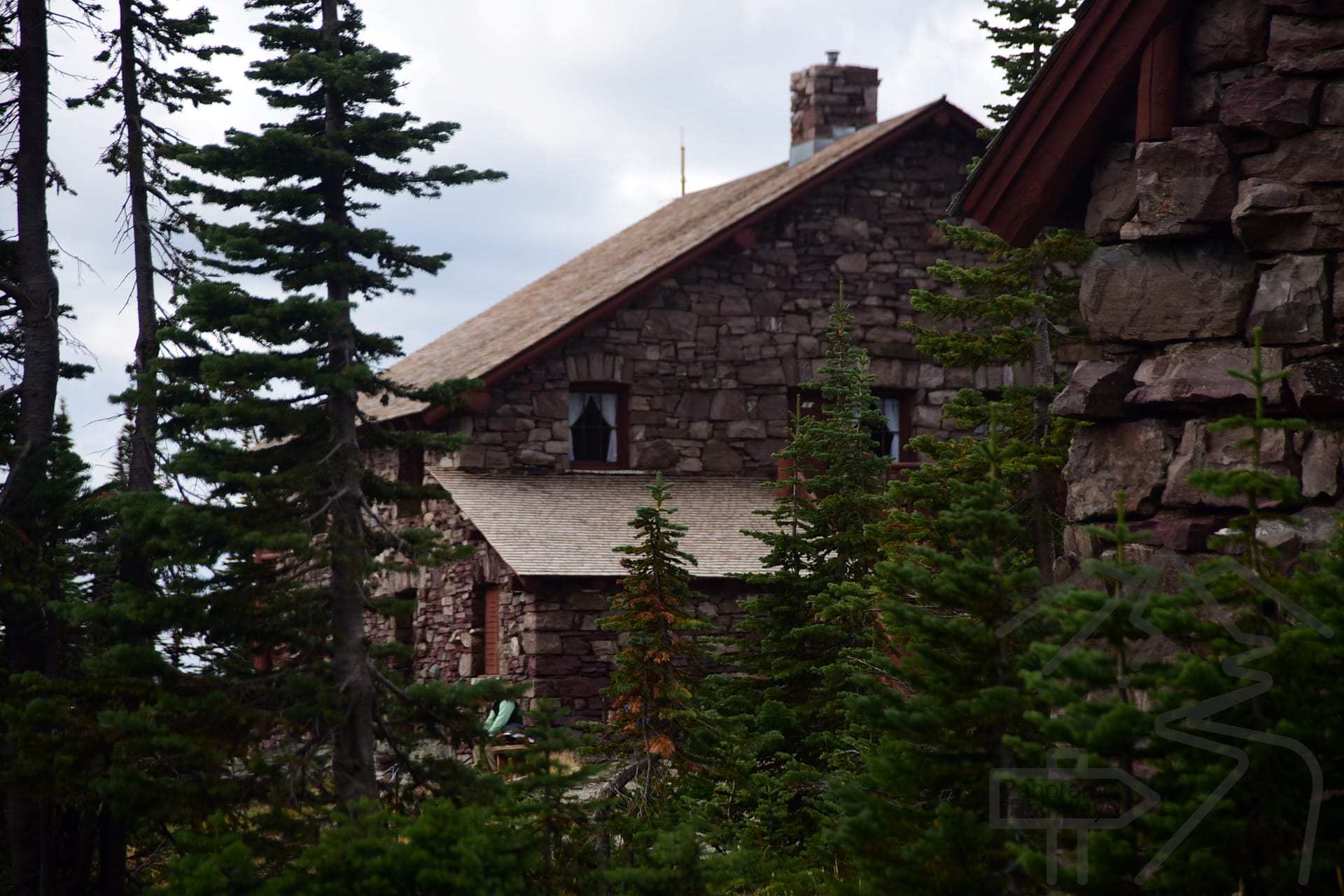
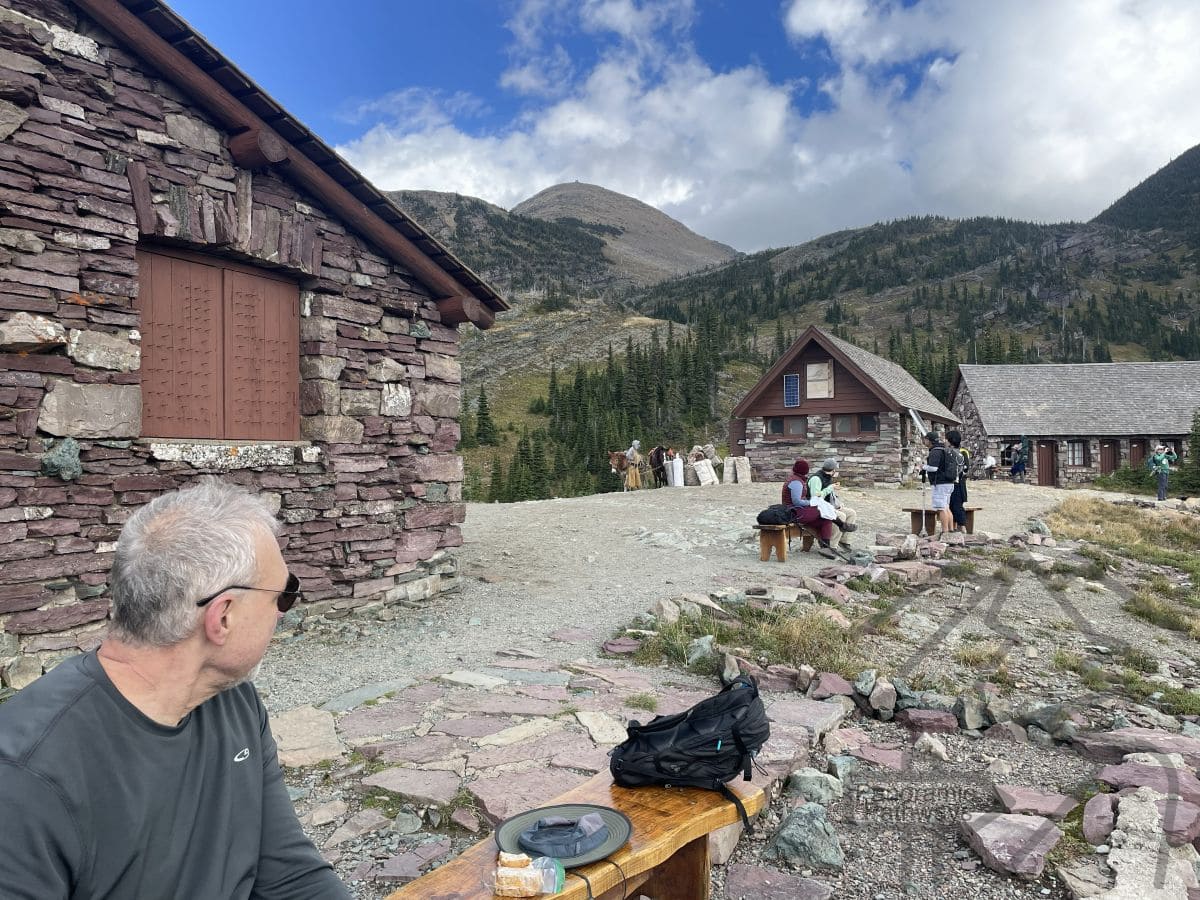
At 7.6 miles, you’ll reach the historic Granite Park Chalet—a welcome sight and a perfect picnic stop. The chalet offers pit toilets, a small counter for drinks and snacks, and outdoor seating with sweeping alpine views.
Overnight stays are available in rustic cabin-style rooms, but reservations must be made well in advance. Most hikers simply pause here before beginning the descent to The Loop.
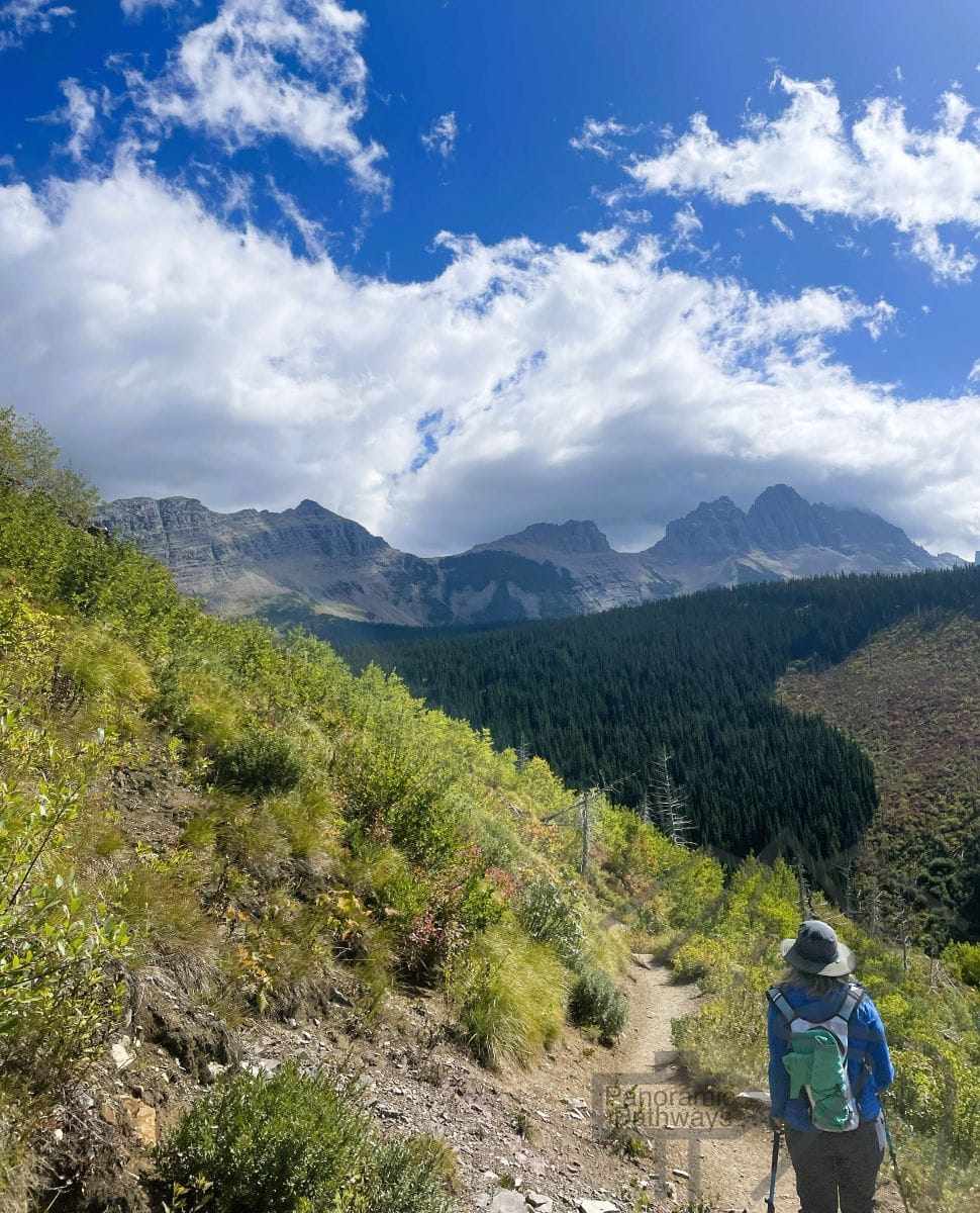
Downhill to The Loop
From the Chalet, the trail drops 4.1 miles down to The Loop—a steady, rocky descent through open terrain. It’s tough on the knees and often hot by afternoon, so this is where those trekking poles really pay off.
Eventually, you’ll emerge at The Loop parking area on the Going-to-the-Sun Road, where there are restrooms and—hopefully—a waiting free park shuttle to take you back to Logan Pass.
We were relieved to step aboard the air-conditioned bus, legs tired but hearts full after one of the most spectacular hikes we’ve ever done.
Getting Back to Logan Pass
A free park shuttle operates along the Going-to-the-Sun Road, making this one-way hike possible without worrying about vehicle logistics. After finishing at The Loop, simply wait at the marked shuttle stop for a ride back up to Logan Pass. Shuttles typically run every 15–30 minutes during the main summer season, but service can vary with weather and crowd levels. For current schedules and updates, visit the Glacier National Park Shuttle System page on the official NPS website.
Why We Recommend Hiking from Logan Pass Down to The Loop
Some hikers start at The Loop and climb up, but we strongly suggest the Logan Pass → The Loop direction. Here’s why:
- You gain less elevation overall.
- You enjoy the best views facing forward throughout the day.
- The hardest climb comes early when you’re fresh.
- And best of all—you end with a shuttle ride, not a long uphill grind.
It’s the most rewarding way to experience the Highline Trail Logan Pass to The Loop, balancing Glacier’s dramatic scenery with a doable one-day effort.When planning our trip to Glacier National Park, the Highline Trail on the Going to the Sun Road kept appearing high on lists of amazing hikes. Photos lured us in – the hike is absolutely stunning! But the roundtrip hike from Logan Pass to the Granite Park Chalet, recommended by many, is almost 16 miles roundtrip. We knew we didn’t want to hike quite that much! After some research, we discovered that we could continue our hike as a one-way from the Granite Park Chalet down to the Going to the Sun Road at The Loop, a hairpin turn on the GTSR.
Related Guides
Essential Guide to Glacier National Park, Montana
Going to the Sun Road Area Guide, Glacier National Park
Many Glacier Area Guide, Glacier National Park
Two Medicine Area Guide, Glacier National Park
Hiking the Grinnell Glacier Trail, Glacier National Park