Updated December 2025
President Coolidge established Craters of the Moon National Monument and Preserve (“CotM”) in 1924 to protect the “weird and scenic landscape peculiar to itself.” While there are other places in the world where you can see lava terrain, CotM feels truly unique, with its cinder cones, lava caves, and vast volcanic craters. With a mix of scenic drives, short trails, and overlooks, this park is an easy and memorable stop in southern Idaho—and a highlight of any Idaho itinerary.
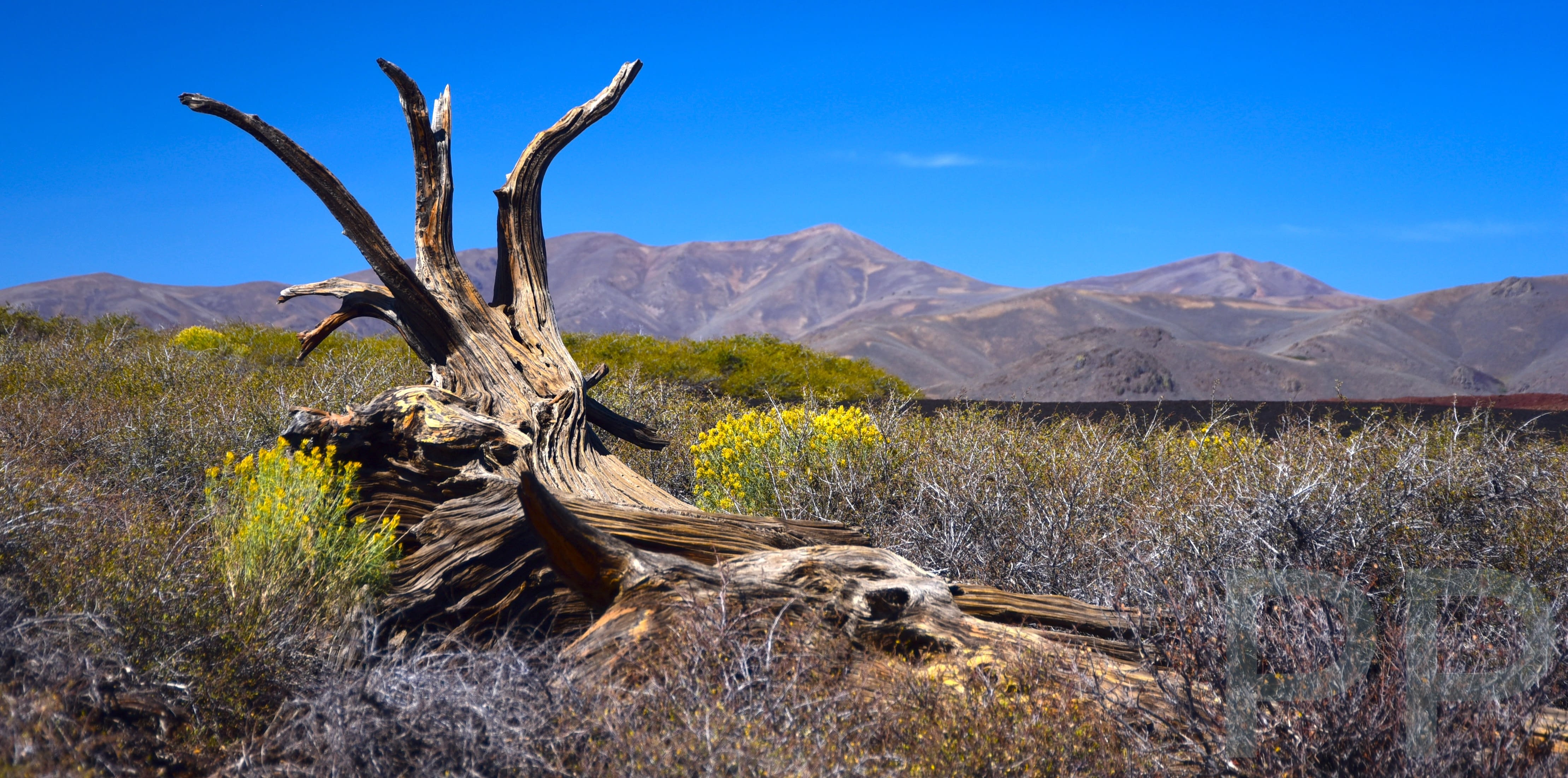
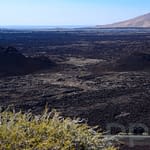
Craters of the Moon feels more like a national park than a monument. Visiting is a surreal, almost otherworldly experience. Idaho is already a state with remarkably varied geography and geology, but CotM offers a rare glimpse into large-scale volcanic activity in the continental United States. With its cinder cones and expansive lava flows, the landscape can feel out of place—until you realize it lies just three hours from Yellowstone National Park.
Much of the park can be seen from the 7-Mile Loop Road, making it possible to visit in just a couple of hours or linger for a half day, depending on how much time you spend at each stop. Hikers will want to allow extra time, especially for the Broken Top Loop Trail, our favorite hike in the park. Visitors interested in caves can also explore several lava tube caves, adding another unique dimension to a visit.
Getting to Craters of the Moon
Craters of the Moon is located just off US Highway 20/26/93, about 18 miles southwest of Arco, Idaho. The drive takes roughly 2.5 hours from Boise and about 1.5 hours from Twin Falls. Other relatively nearby destinations include Salt Lake City, approximately 4.5 hours to the south, and Yellowstone National Park, about a three-hour drive to the northeast.
The park entrance fee is $20 per vehicle, or you can use an America the Beautiful Pass, which provides annual access to U.S. national parks and federal lands. While the park itself is open year-round, the 7-Mile Loop Road is typically closed to vehicles from early December through the end of April. Visitors during the winter season should check current road conditions in advance. For those interested in cross-country skiing or winter camping, Craters of the Moon can be a rewarding cold-weather destination.
7-Mile Loop Road ★★★
The main attraction at Craters of the Moon National Monument is the 7-Mile Loop Road. The park brochure map highlights seven designated “points of interest,” beginning at the Visitor Center and ending at the Caves Area. Five of these points are located directly along the loop road, with one additional area accessed via a short spur road. Below, we describe the sights and trails found at each of these points of interest.
#1 – Robert Limbert Visitor Center – Craters of the Moon National Monument
The Robert Limbert Visitor Center is located just inside the preserve off US Highway 20. It offers good facilities along with the typical displays and information you would expect at a national park site. It’s worth stopping here to pick up the park activities and events newspaper and to learn about ranger programs and other seasonal offerings. Be sure to obtain a free permit for the caves (see #7 below), as required. The campground entrance is located just beyond the visitor center.
#2 – North Crater Flow Trail
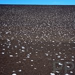
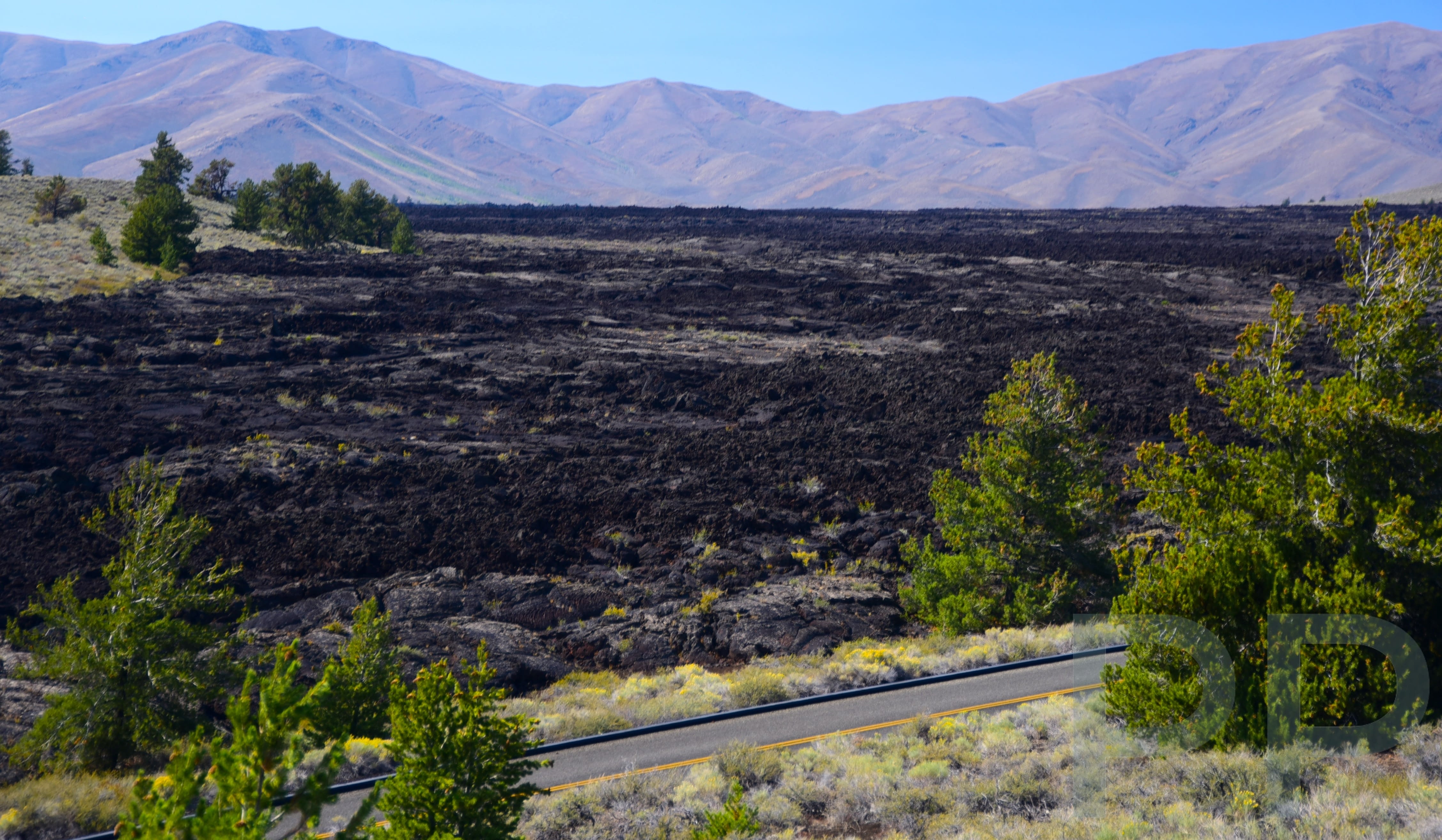
About a half mile past the visitor center, on the right, is the North Crater Flow Trail, a short, paved loop that winds through a lava field. Portions of the trail include a boardwalk that crosses the flow. White salt deposits contrast sharply with the dark lava, making this a particularly good photo stop. This flow is an example of pahoehoe lava (see lava flow types), one of several types of lava formations found within Craters of the Moon. From the trail, you can also see the North Cone.
The drive to the next point of interest is worth taking slowly. Several pull-offs provide opportunities to view different lava formations and vegetation fields. In early summer, especially in June, wildflowers bloom throughout the monument.
#3 – Devil’s Orchard Nature Trail
Devil’s Orchard is the next point of interest as you continue driving toward the loop road. This area offers ample parking along with picnic tables, making it a convenient stop. The nature trail is a short 0.5-mile paved loop and is fully accessible. Along the way, interpretive signs provide information about the geology and vegetation, with views of colorful and unusual rock formations throughout the area.
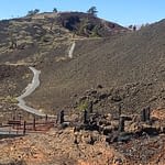
#4 – Inferno Cone
Next is Inferno Cone, a popular stop with ample parking at the trailhead. From the parking lot, the trail to the top of the gray cinder cone is clearly visible, leading to 360-degree views of Craters of the Moon and the surrounding landscape. Looking south, you can see several volcanic cones and sinks, while to the southwest lie extensive lava flows, along with the Spatter Cones and Snow Cone. To the northeast are the Pioneer Mountains and the Snake River Plain. On especially clear days, the Teton Range—nearly 100 miles to the east—can sometimes be seen.
#5 – Snow Cone and Spatter Cones
It is a short drive from the Inferno Cone parking lot to the Spatter Cones parking area. From here, a brief 0.1-mile trail climbs to the Spatter Cone, where you can look down into a small, inactive volcano. An even shorter trail leads to Snow Cone, allowing you to peer into its vent. Both stops can be visited in less than 30 minutes, and the Snow Cone trail is wheelchair accessible.
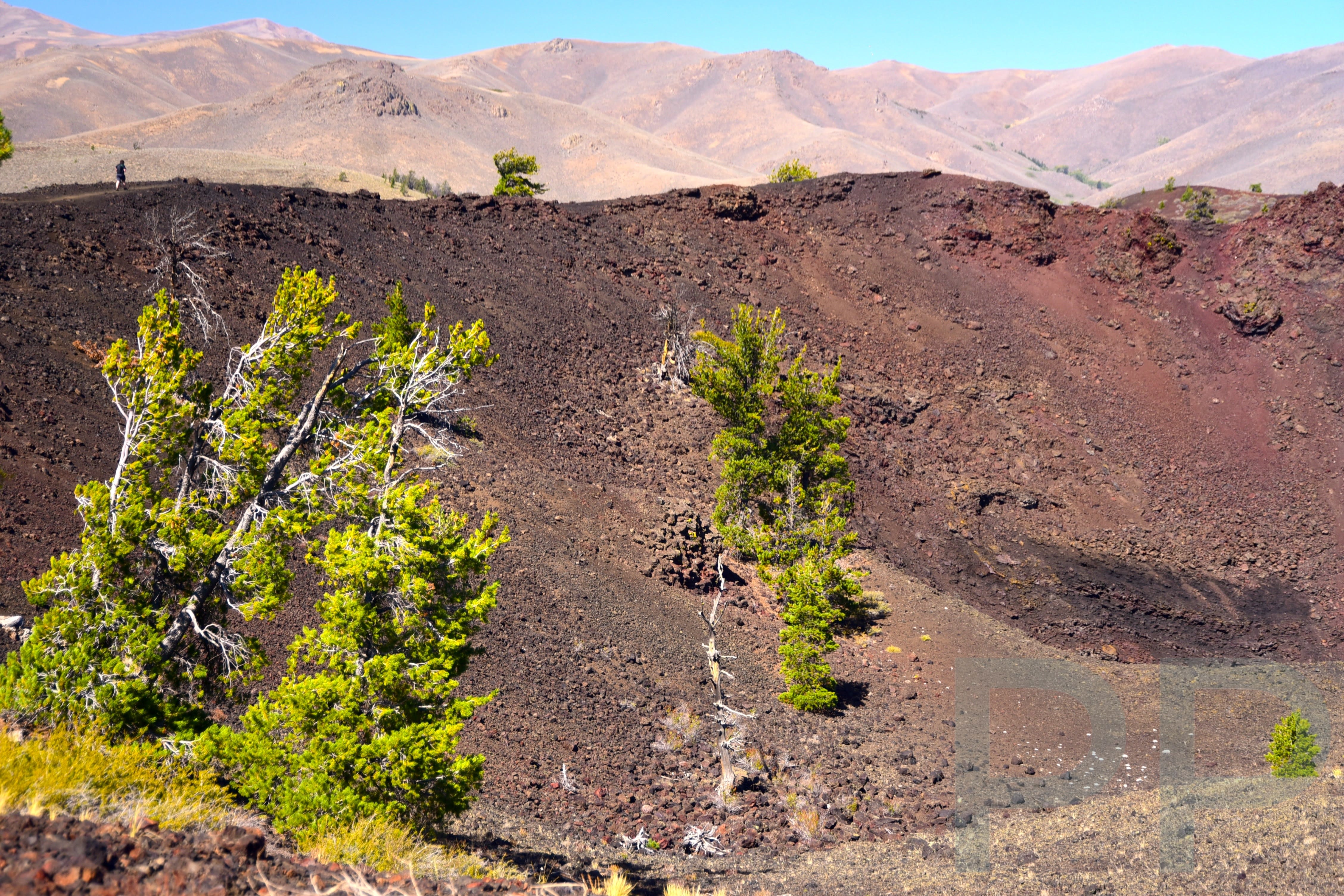
From the Spatter Cones trailhead, you can also access the North Crater Trail (1.75 miles one way), which connects back to the North Crater Flow Trail parking area. Although the full 3.5-mile round trip may be more than some visitors want to tackle, hiking even the first half mile provides views of the impressive Big Craters. Be careful not to confuse this trail with the similarly named North Crater Flow Trail.
The elevation gain from the Spatter Cones parking area to the highest viewpoints is about 700 feet. From these vantage points, you’ll enjoy expansive views of Big Crater to the west, as well as additional cones and the wilderness area to the south. The North Crater Trail then follows the crater rim before gradually descending toward the North Crater Flow area.
#6 – Tree Molds and Broken Top Area
Next is the Broken Top Area, accessed via the Tree Molds parking lot, which is located about 1.25 miles off the loop road. Three trails are accessible from this parking area. The trailheads for both the Tree Molds Trail and the Broken Top Loop Trail (each 1.8 miles) are located at the south end of the lot. The Wilderness Trail (7.6 miles) branches off to the right from the Broken Top Loop Trail just a tenth of a mile from the start.
Overnight backpacking trips in the wilderness area require permits, which are free and available at the Visitor Center. Be aware that many caves within the wilderness area are often closed to protect bat populations.
Broken Top Loop Trail – Our Favorite Hike ★★★
The Broken Top Loop Trail is a fantastic hike at Craters of the Moon that allows visitors to see a wide variety of features with minimal time and energy investment. The trail is 1.8 miles round trip, relatively flat, and accessed from the Tree Molds parking lot. Along the way, it showcases multiple types of lava formations and flows, as well as excellent views of the park and surrounding landscape.
Interpretive signs help explain the geology, making this an especially educational hike and a good option for families. Be sure to take the short spur to the Big Sink Overlook, located about halfway around the loop. While the trail also provides access to the Buffalo Caves, these are currently closed to protect bat populations.
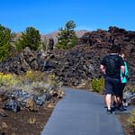
#7- Caves and Tunnels at Craters of the Moon ★★
The final point of interest along the loop road is the Caves Area. Although it appears last on the list, it is certainly not the least. Four caves are accessed via a 1.6-mile round-trip trail. After about half a mile, the trail splits: the path to the right leads to Indian Tunnel Cave, the path to the left leads to Boy Scout Cave and Beauty Cave, and Dewdrop Cave is located at the junction. A free permit, available at the Visitor Center, is required to enter Indian Tunnel Cave and Dewdrop Cave. At the time of writing, Boy Scout Cave and Beauty Cave are closed to protect bat populations.
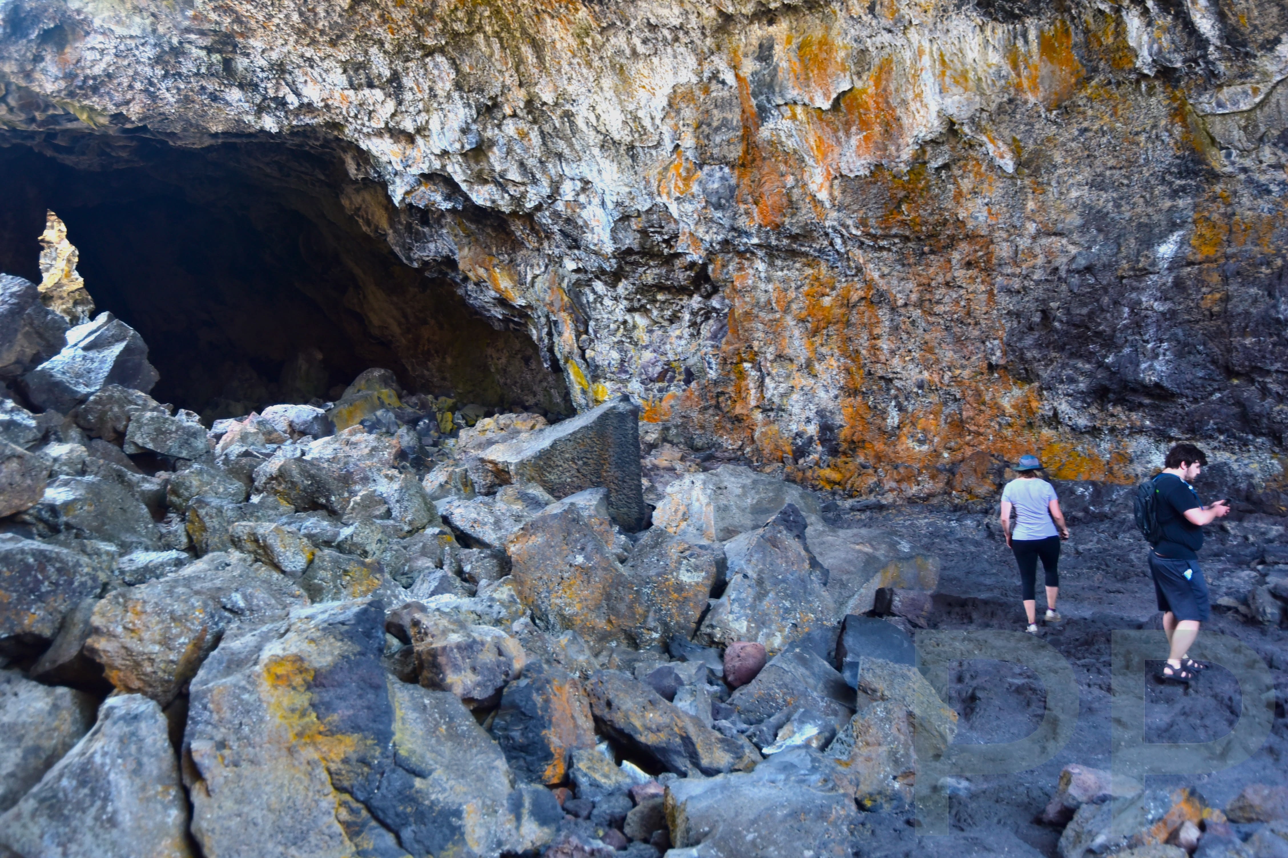
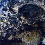
Indian Tunnel was our favorite cave. It has two entrances and good visibility throughout much of the interior. Like the other caves at Craters of the Moon, it is a lava tube formed by flowing lava, part of which later collapsed. Stairs at the far end make exiting the cave straightforward.
Dewdrop Cave is small and has a narrow entrance, so it may be worth skipping if it is crowded.
Beauty Cave, when open, is deep and very dark, allowing visitors to experience near-total darkness. The entrance requires climbing over several boulders to reach the cave floor. A flashlight is necessary to explore the cave interior; a cell phone light is usually sufficient.
Cave access frequently changes at Craters of the Moon to protect bat populations. Posted signs and the Visitor Center will have the most up-to-date information on which caves are open.
Craters of the Moon Trails and Other Sights
The following table provides an overview of the main trails at Craters of the Moon National Monument and Preserve:
| Trails | Length (miles) | Description and Difficulty |
| North Crater Flow | 0.3 | Easy paved loop trail. Wheelchair accessible. |
| Devil’s Orchard Nature Trail | 0.5 | Easy gravel trail. Loop |
| Inferno Cone | 0.8 | Moderate with a climb to the top of the Cone. In-and-Out. |
| Snow Cone and Splatter Cones | 0.2 | Easy and wheelchair accessible. |
| North Crater Trail | 3.5 (round trip) | Moderate in-and-out trail. Elevation gain 758 ft. From either North Crater Trailhead or Spatter Cones Parking Area |
| Broken Top Loop Trail | 1.8 | Moderate loop with elevation gain: 242 ft (74 m). From Tree Molds Parking |
| Tree Molds Trail | 1.8 | Easy in-and-out trail. From Tree Molds Parking |
| Wilderness Trail | 7.6 | Moderate. In-and-out, remote trail. Check on permit at Visitor Center. |
| Caves Trail | 1.6 | Easy. In-and-out flat to four caves: Dewdrop, Indian Tunnel, Boy Scout, and Beauty. |
More information on the wilderness area and backpacking can be found at the NPS site here.